Bindjareb-Peel Geo Park Guide
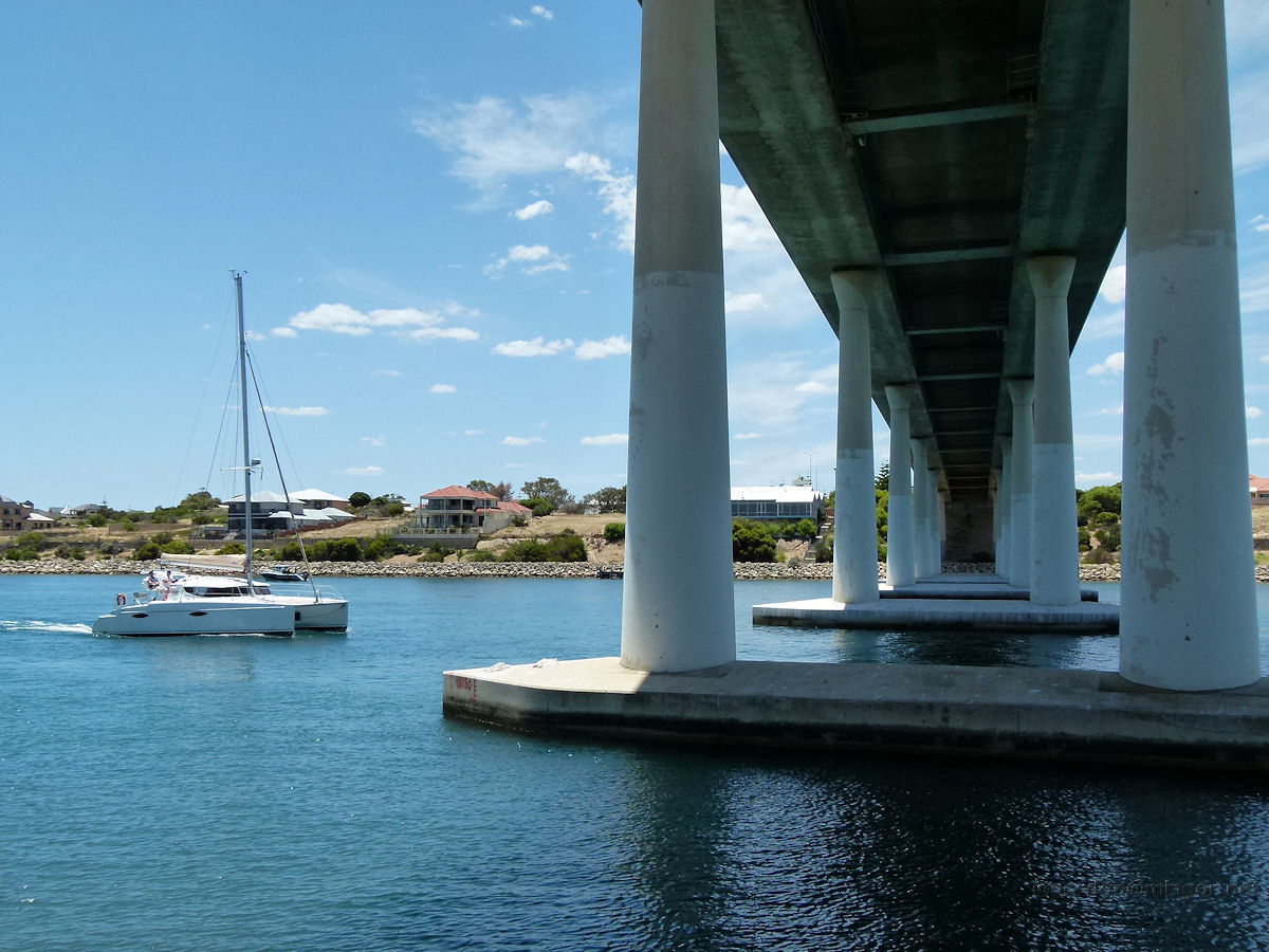
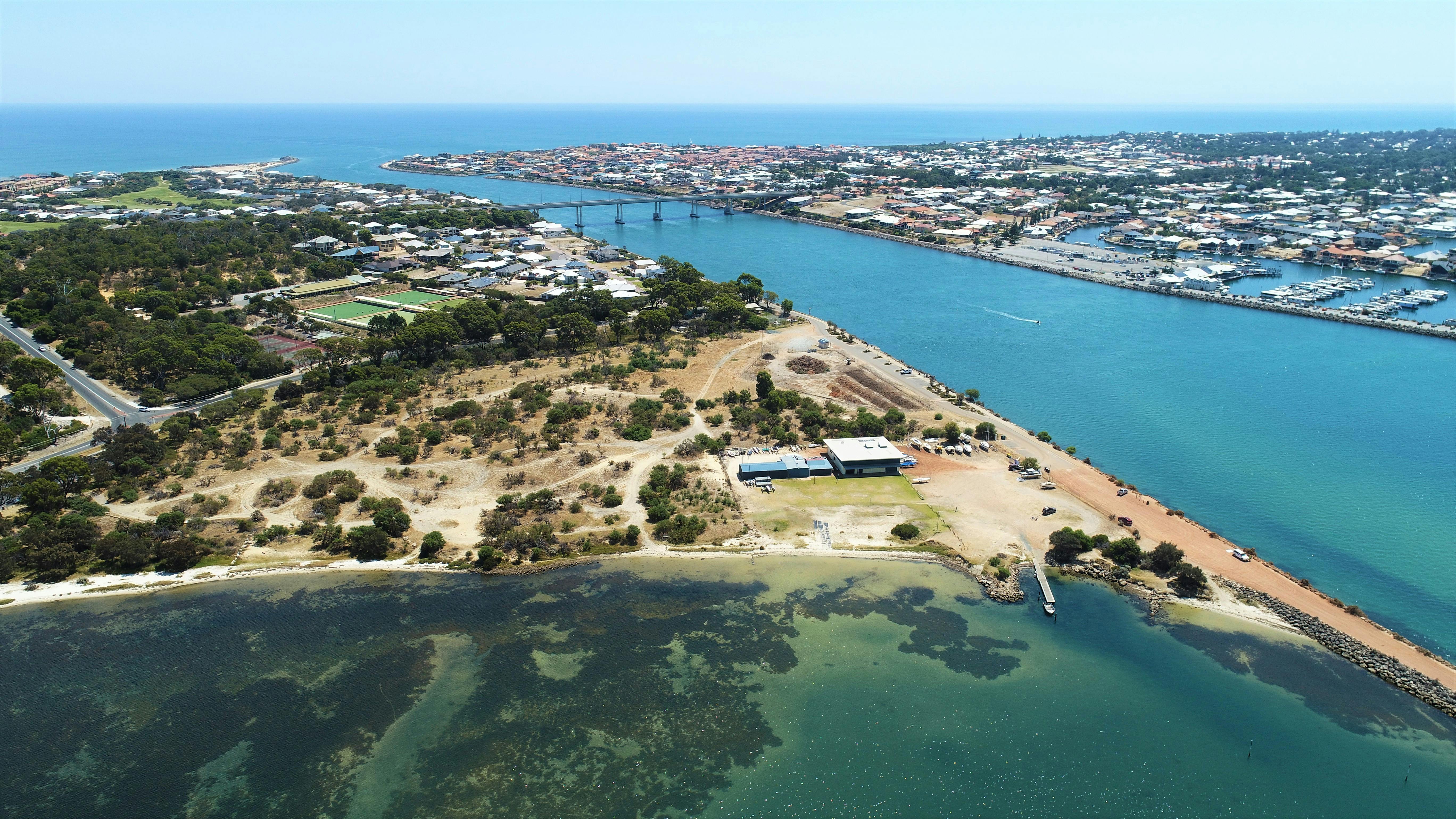
Dawesville Cut
Built in 1994, the 2.5 km Dawesville Cut links Peel Inlet to the Indian Ocean. The cut is about 80 km south of Perth and 14 km south of the regional city of Mandurah. Its coastal estuarine scenery and abundant wildlife make this site one of the most popular spots in Dawesville for boating, fishing, birdwatching and hiking.
Accessibility
carparkdisability accessdisability parkinghard surface path
Activities
bird watchingcanoeing kayakingfishingnature photographyswimmingwalking
Astrophotography potential
tables hardstandunobstructed view
Astrophotography grade
None
Facilities
bbqbike rackcampsitecaravan parkgrass areahotelnightime lightingpicnic areaviewing platform
Way finding
basic identificationdirectionalinformationalregulatory

Address
Location
Footpath underneath Port Bouvard Bridge, Dawesville WA 6211
Indigenous community
Bindjareb people
Land tenure
City of Mandurah
Entry road
Sealed Road (Bi-Directional)
Car park distance (m)
100
Entry fee
No
Infrastructure grade
9
Natural amenity
7
Plumbed infrastructure
Yes
Visible powerlines
Yes
Coordinates (lat, lng)
-32.567, 115.641
Tours & experiences
Dawesville Foreshore Reserve Walk, Perth-Peel Coastal Walk Trail
Site Highlights
You may also want to know...
- Built in 1994, the 2.5 km cut links Peel Inlet to the Indian Ocean, about 80 km south of Perth and 14 km south of Mandurah.
- Coastal estuarine scenery and abundant wildlife support boating, fishing, birdwatching and hiking.
Biotic features
Flora: The discharge of nutrients into the Peel-Harvey estuary resulted in it becoming eutrophic. Growths of macroalgae in the form of toxic cyanobacteria Nodularia spumigena began to occur on a seasonal basis. The combination of sunlight and stagnant, nutrient-rich, heated water caused massive blooms of blue-green algae. Professor Arthur McComb and Ernest Hodgkin identified that the cause of the blooms was the phosphorus load in the water, resulting from run-off associated with agricultural and industrial practices in the catchment area.
Fauna: The Peel-Harvey Estuary hosts abundant invertebrates, crustaceans, fish, and waterbirds. Key species such as blue manna crab, king prawn, whiting, and mullet support commercial and recreational fisheries, while its migratory waterbird populations hold international conservation significance.
Abiotic features
The cut is an artificial channel between the Peel-Harvey Estuary and the Indian Ocean at Dawesville. At the coast, the channel cuts through Tamala Limestone outcrops, overlain to the east by mobile Safety Bay Sand dunes. Between the shoreline and the Harvey Estuary, Tamala Limestone occurs as variably lithified calcarenite or associated sands. Beneath the estuary lie Holocene lagoonal clays, silts, and sands, which overlie Tamala Limestone; this unit, in turn, rests on Lower Cretaceous sediments at depths greater than 10 m below sea level.
Cultural aspects
European — Prior to the canal's construction, large areas of the estuarine system, spanning roughly 131–136 km² with depths of 1–2 m, had become eutrophic and were a major political and environmental issue for the Government of Western Australia during the mid-1980s. This nutrient enrichment severely reduced the system's capacity to sustain native flora and fauna, and was accompanied by the odour of decomposing algae. Construction of the channel began in 1990 and finished in April 1994, creating a 2.5 km long, 200 m wide, 6–6.5 m deep waterway through the removal of approximately 4.5 million m³ of material.