Bindjareb-Peel Geo Park Guide
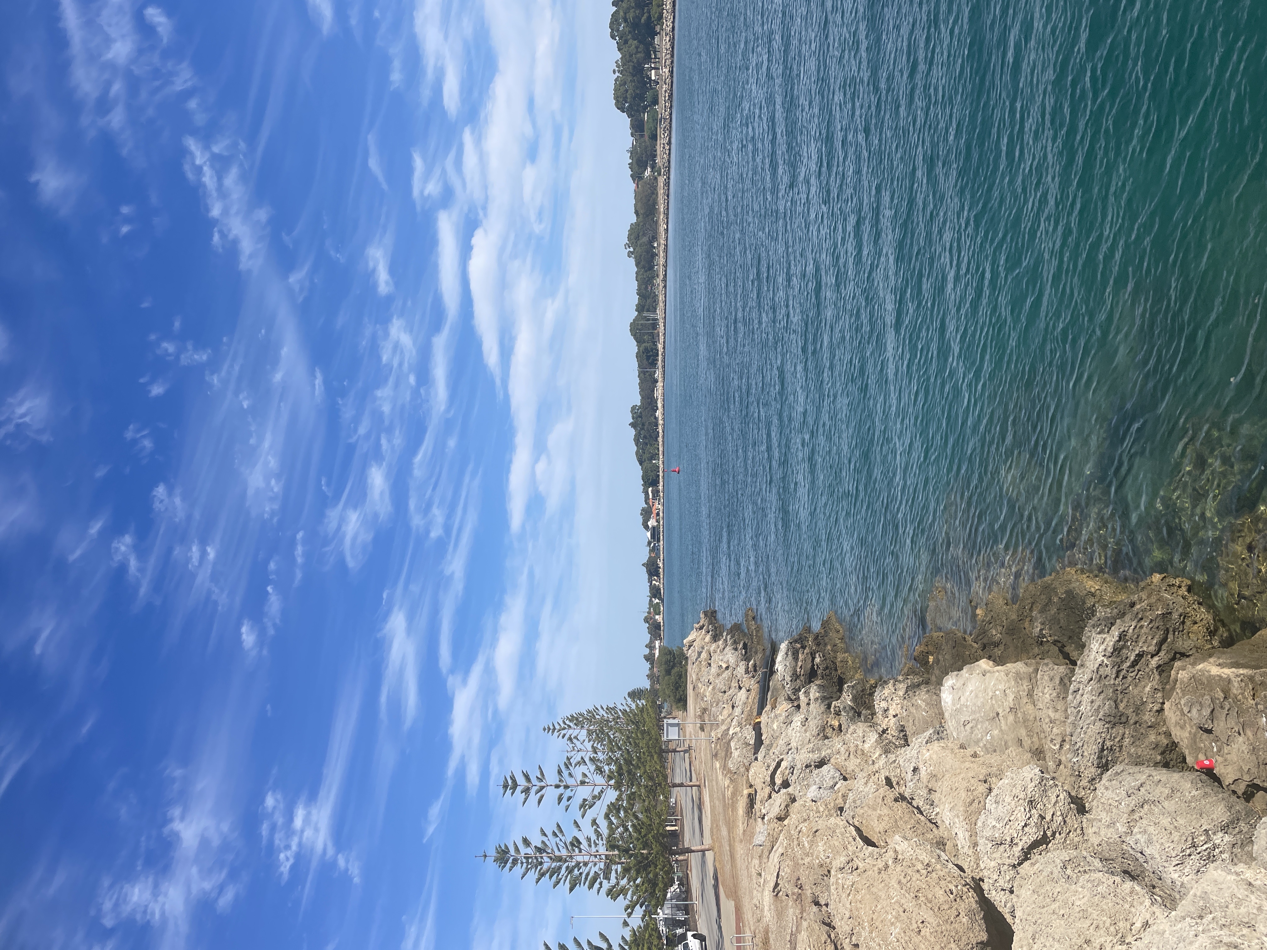
Mandurah Channel Entrance
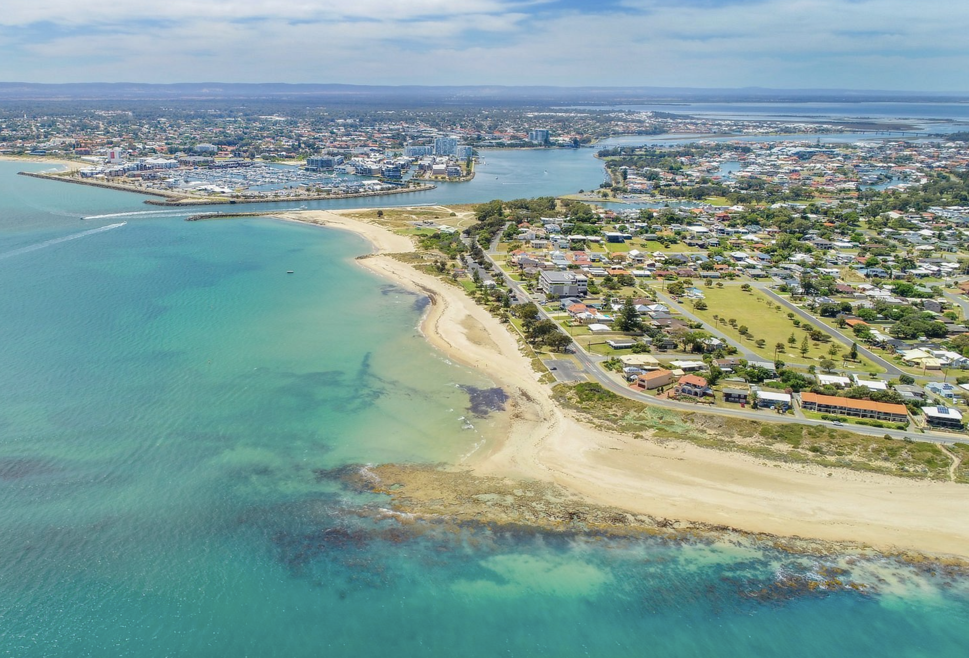
The Mandurah Channel Entrance refers to the point where the Mandurah Estuary connects to the Indian Ocean. It is a critical area for boating, as it allows access to the Mandurah Estuary and Peel Inlet. The channel is maintained through dredging and sand bypassing to ensure safe navigation depths. The catchment of the Peel-Harvey Estuary is 12,000 square km.
Accessibility
carparkhard surface pathramp
Activities
bird watchingboatingfishingnature photographyswimmingwalking
Astrophotography potential
No Astrophotography Potential
Astrophotography grade
None
Facilities
bike rackgrass areahotelnightime lightingpicnic areaviewing platform
Way finding
No Way Finding Support
Address
Location
75-185 Breakwater Pde, Mandurah, Perth, Western Australia, 6210, AUS
Indigenous community
Bindjareb People
Land tenure
City of Mandurah
Entry road
Sealed Road (Bi-Directional)
Car park distance (m)
20
Entry fee
No
Infrastructure grade
8
Natural amenity
8
Plumbed infrastructure
No
Visible powerlines
No
Coordinates (lat, lng)
-32.522, 115.712
Food & drink
Redmanna Waterfront Restaurant, The Cray
Tours & experiences
Giant and Dolphin Sightseeing Cruise, Mandurah Pirate Cruise, Mandurah Cruises Seafood Experience
Site Highlights
You may also want to know...
- The Mandurah Channel Entrance refers to the point where the Mandurah Estuary connects to the Indian Ocean.
- It is a critical area for boating, as it allows access to the Mandurah Estuary and Peel Inlet.
- The channel is maintained through dredging and sand bypassing to ensure safe navigation depths.
Biotic features
Fauna: Water flow through the channels is primarily influenced by tidal fluctuations and the volume of freshwater flowing in from nearby rivers. This dynamic environment supports a range of wildlife. Ninety Indo-Pacific bottlenose dolphins (which collectively catch over 200,000 kg of fish from the estuary annually) and a range of waterbird species, which rely on the area for feeding and habitat, have been observed. Over 70 species of fish have been identified in the Peel-Harvey estuary including herring, yellow-eye mullet and black breams.
The Peel-Harvey Blue Swimmer Crab Fishery is the world’s only Marine Stewardship Council certified commercial and recreational fishery. Close to 100 tonnes of crab a year is collected by commercial fishers, all of which are sold locally. Flora: A variety of seagrasses grow in the estuary's waters and provide nutrient rich food for a complex of marine animals.
Abiotic features
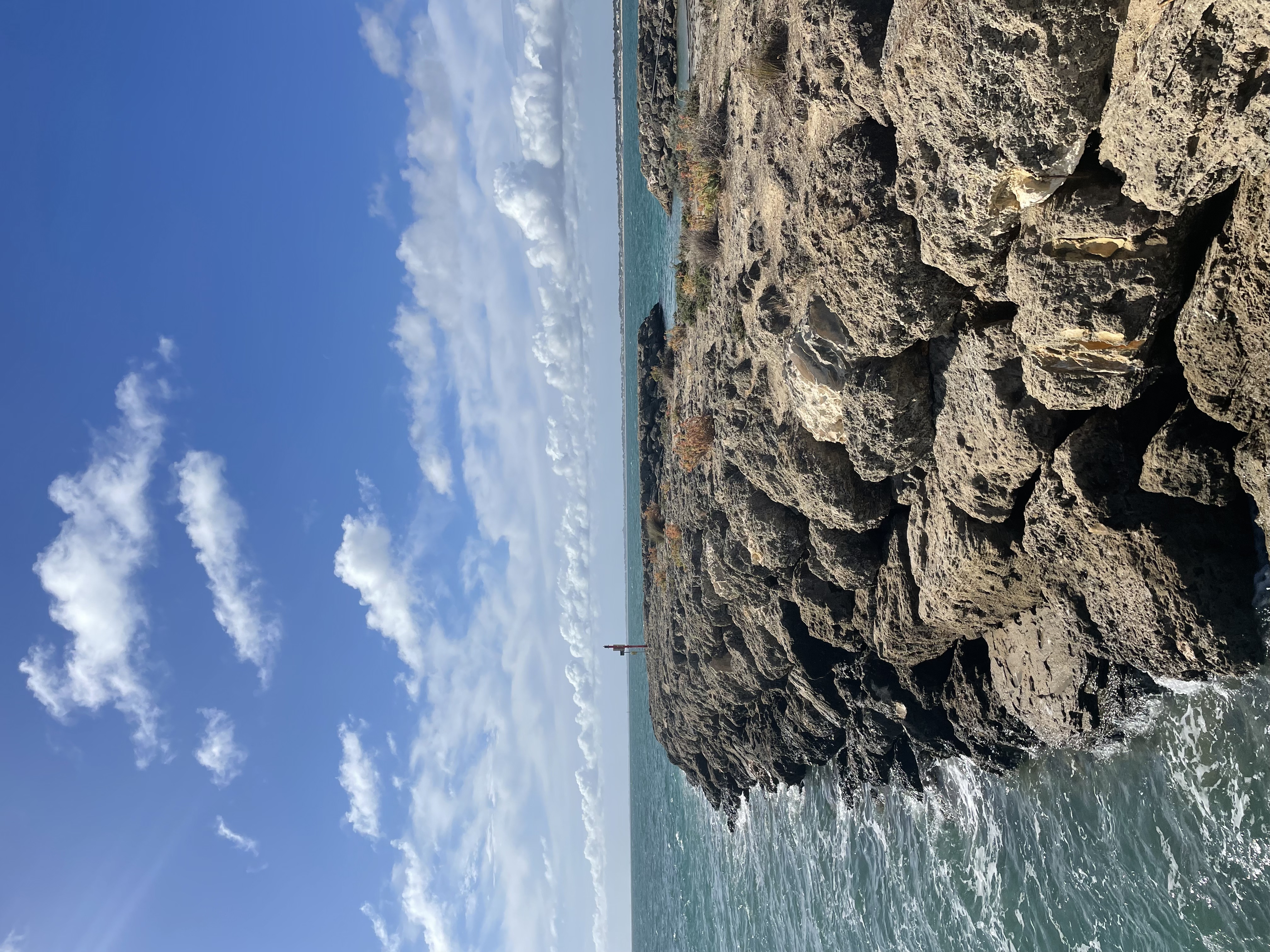
The Mandurah Channel Entrance is the meeting point of the Peel Estuary to the Indian Ocean. The channel serves as an outlet for the Serpentine, Murray and Harvey Rivers. The Peel Estuary is a Basin Estuary and connects to the Harvey Estuary, which is an inter-barrier estuary that lies behind the Spearwood dune System. In its natural state, Peel Harvey Estuary is composed of layers of sediments that were deposited by rivers and seas, they were sculpted by winds during the last 10,000 years since the most recent Ice Age. The rising sea levels (approximately 8,000 years ago) that followed the melting of the ice caps flooded old river valleys forming the Peel-Harvey Estuary. The bottom sediments of the estuary contain marine shells from 4000 to 5000 years ago. Prior to human modifications, the area functioned as a typical estuarine flood-tide delta with a large network of sand spits and vegetation (closed off to the ocean). Strong water flow would break open its mouth and connect it to the Ocean.
Cultural aspects
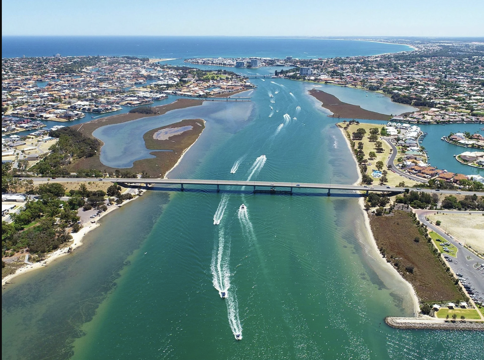
Dr. A. Collie and Lt. Preston explored the Mandurah Channel Entrance into the estuary in November 1829. In the 1940’s, after regular blockage of the channel, training walls were built to ensure a hydraulic connection each year. Their spacing was designed to ensure that riverine floods could be carried without back flooding the agricultural drainage area adjoining Peel and Harvey Inlets. Permanent navigation was not anticipated when they were built. Sand bypassing was found to be needed to avoid a sea erosion threat to down-drift urban development. Bypassing was also intermittently carried out to allow the commercial fishing fleet to access the ocean during the rock lobster season. With development of canal estates and the Mandurah Ocean marina (which is built on accreted littoral drift sand in previous sand bar areas) bypassing volumes have been increased to allow for recreational navigation. Monitoring of depths, and occasional navigational diversions, have been a part of the ongoing bar management. 2021 saw $1.58 million joint investment through the City of Mandurah and the Department of Transport, and it was the largest amount of material moved in one campaign being recorded. Approximately 220,000 cubic metres of sand had been excavated from Halls Head Beach and pumped eastward on to nearby Town Beach during the five-month project which is essential to maintain the entrance channel.