Bindjareb-Peel Geo Park Guide
White Hills Lookout
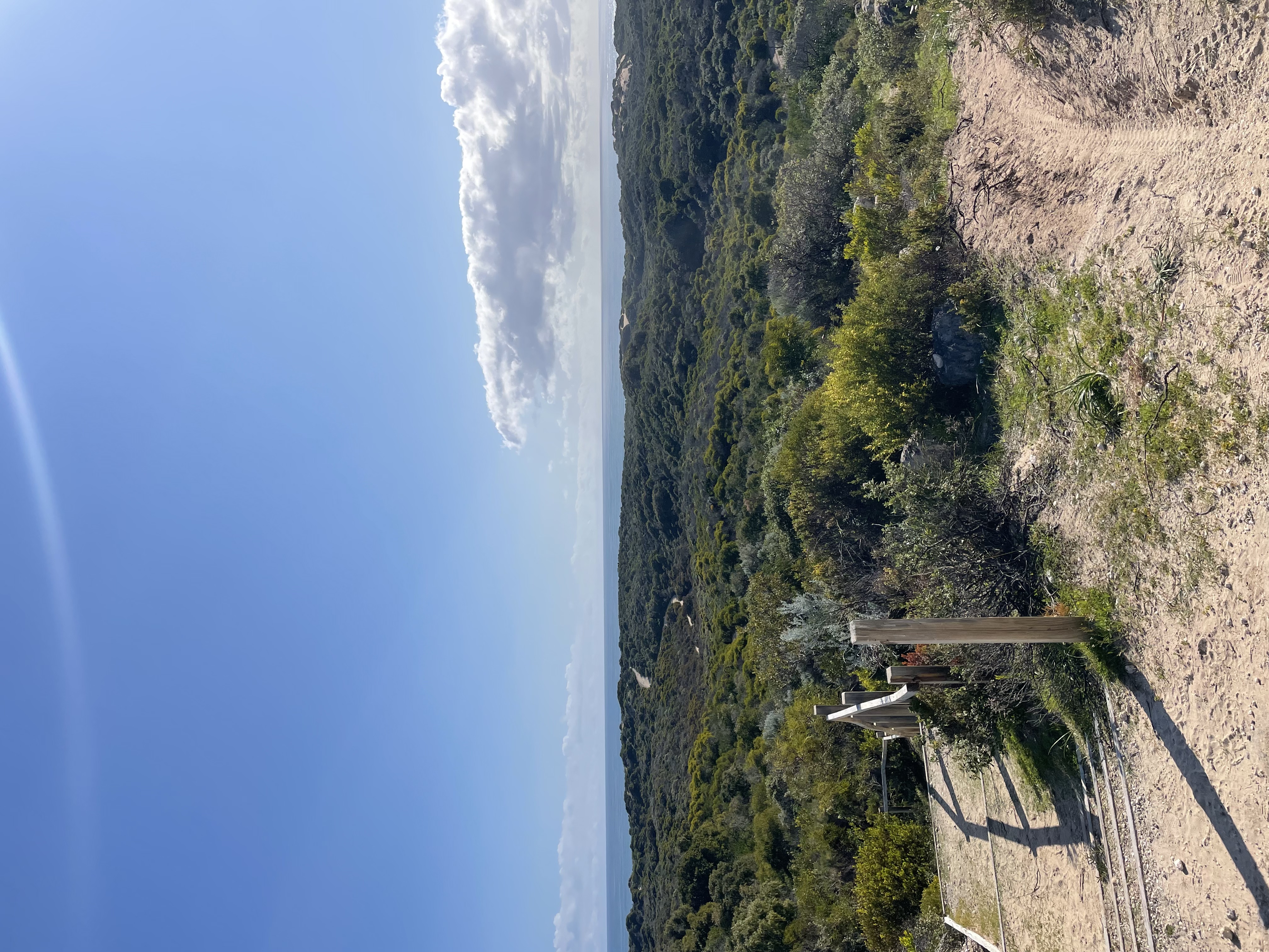
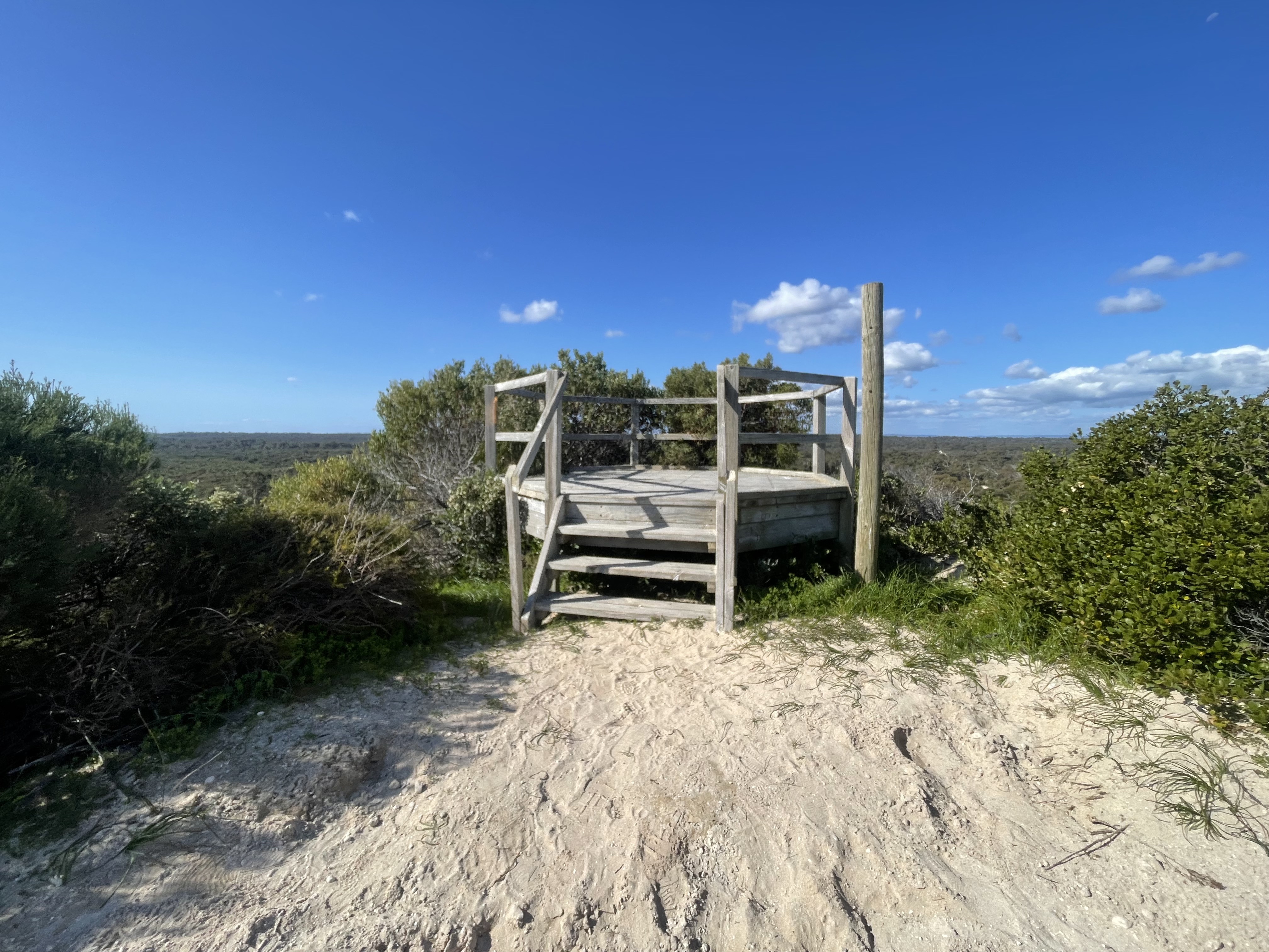
White Hills Lookout is located in Bouvard, 17km south of Mandurah, on Old Coast Road. The viewing deck provides 360 views of the Indian Ocean (Wardan), Yalgorup National Park and iconic Bouvard Reefs.
Accessibility
carparksoft surface path
Activities
bird watchingcanoeing kayakingfishingmountain bikingnature photographyswimmingwalking
Astrophotography potential
No Astrophotography Potential
Astrophotography grade
None
Facilities
campsitecaravan parkhotelpicnic areaviewing platform
Way finding
No Way Finding Support
Address
Location
White Hill, Bouvard, Mandurah, Western Australia, 6211, AUS
Indigenous community
The use of the sea was considered important to Noongar people. Marine resources including spearing of seals, camping along the coast to fish, which was important to the family economy. There are several fish traps known along the coastline. The Noongar People are the native title claimants for south-west Western Australia. They have also agreed an Indigenous Cultural Heritage Land Use Agreement (ILUA) between the state of Western Australia and the Gnaala Karla Booja people within the larger Noongar native title area. This agreement covers the sea within a 3 nautical mile limit.
Land tenure
City of Mandurah
Entry road
Sealed Road (Bi-Directional)
Car park distance (m)
40
Entry fee
No
Infrastructure grade
7
Natural amenity
9
Plumbed infrastructure
No
Visible powerlines
No
Coordinates (lat, lng)
-32.687, 115.614
Tours & experiences
Lake Pollard Walk Trail + Heathlands Walk Trail + Lakeside Loop Walk Trail
Site Highlights
You may also want to know...
- White Hills Lookout is located in Bouvard, 17km south of Mandurah, on Old Coast Road.
- The viewing deck provides 360 views of the Indian Ocean (Wardan), Yalgorup National Park and iconic Bouvard Reefs.
Biotic features
Flora: White Hills Lookout is set amidst coastal heath tuart banksia woodland and paperbark swamp communities that are dominated by grass trees and hakea. Bouvard Reef (visible from the platform) promotes high diversities of seagrass and other benthic communities due to warm water intrusions of the Leeuwin Current. The shallow continental shelf and clear waters, allow for high levels of light penetration, which promote a high diversity of seagrass and other benthic communities
Fauna: The surrounding Yalgorup National Park is recognised under the 'Ramsar Convention' as an important waterbird and trans-equatorial wader habitat (Parks and Wildlife, 2019). Surveys conducted identified a high abundance of black-winged stilt, red-necked avocet, pacific black duck and musk duck. The Endangered Carnaby’s Cockatoo, Baudin's Cockatoo and vulnerable Forest Red-Tailed Black-Cockatoo are known to roost and forage in this geological region. The Bouvard Reefs are recognised as an area of global significance for rare and endangered marine mammals and seabirds. These include pink snapper, pygmy blue whale and the fairy tern.
Abiotic features
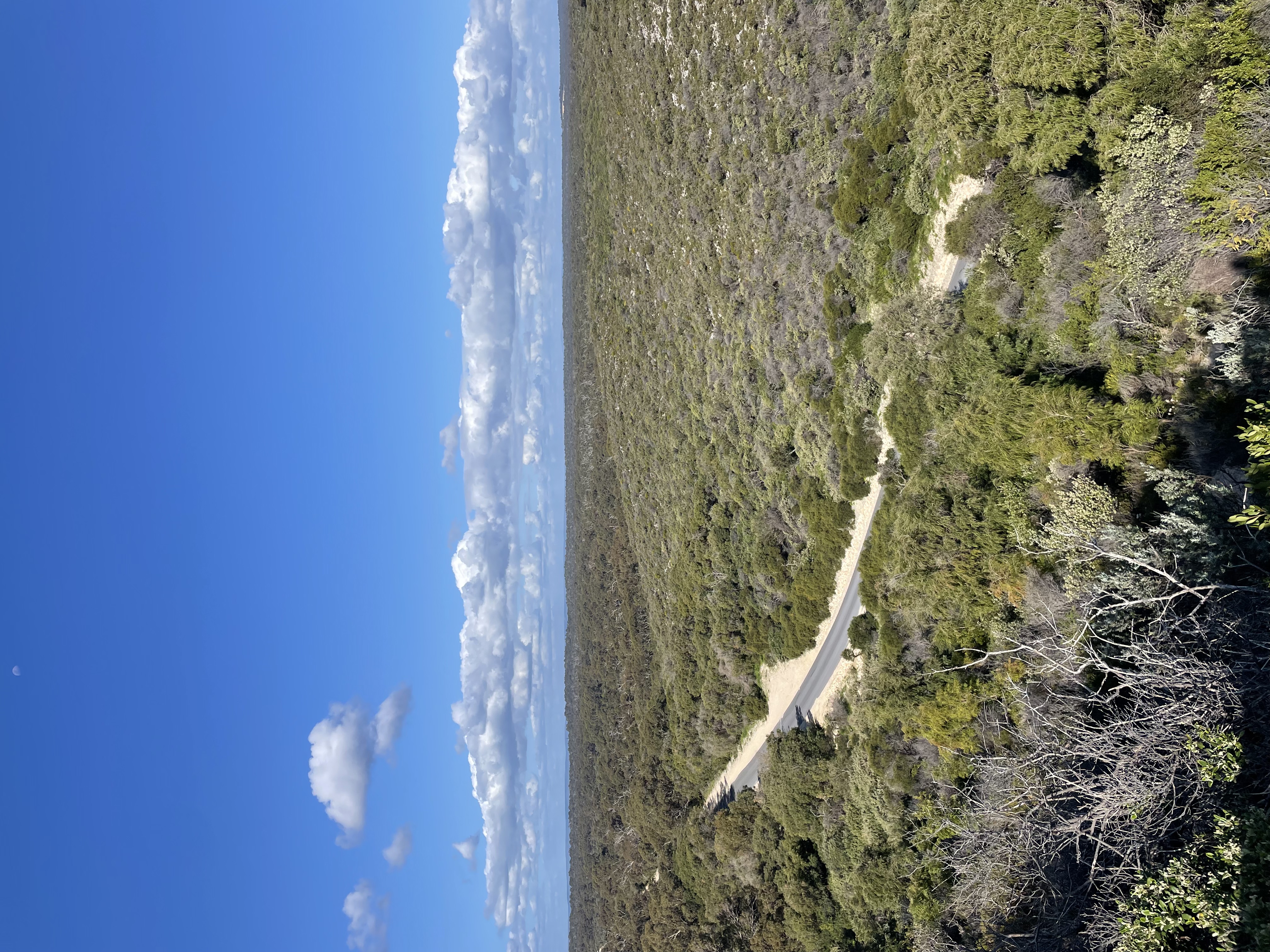
The unobstructed views of the Yalgorup landscape allow for a visual representation of the regional geological setting. Significant geological features that can be interpreted from this vantage point include: The Bouvard Reefs, Quindalup dune system, Yalgorup plain and Mandurah-Eaton ridge. The soil on which White Hills Lookout lies, comprises of mostly calcareous material extracted from seashells and marine organisms. Additionally, the Bouvard reefs are an offshore submerged Tamala limestone ridge and serve as the southern extension of the ridge of the Five Fathom Bank. The offshore reef ridge intersects the coast south of the Bouvard Reef system. This represents a barrier dune with aeolian dunes, formed when the sea levels were lower than present levels. The limestone rocks that appear on the surface of the coastline derive from the ancient Spearwood dune system (formed in the last 10,000 to 140,000 years). The visible Spearwood dune systems have discharged sands at the surface of the coastline, and produced the yellowish-red subsoils that lie underneath the gravelly yellow/brown duplex topsoils, visible from the viewing platform. The Bouvard reefs are an offshore submerged Tamala limestone ridge, representing the barrier dune with aeolian dunes formed when the sea levels were lower than present levels.
Cultural aspects
Aboriginal: The Whitehills Lookout is situated amongst Yalgorup National Park, the name Yalgorup is derived from two Noongar Aboriginal words; yalgor, meaning ‘a swamp or lake’, and up, meaning ‘a place of’. There have been discoveries of stone artefacts and two significant Aboriginal sites near the park including ; Morfitt’s Cave and a ceremonial site. The Indian Ocean, which can also be viewed from the lookout, provided marine resources which the Noongar people utilised. Spearing seals and camping along the coast to fish (Jones and Van Jones) was common practice.
European: European exploration of the area began in 1829, when Alexander Collie and William Preston named Lake Preston and Clifton, while surveying the coast between Mandurah and Bunbury. In the 1850s, convict labour was used to rebuild the Old Coast Road, south of Mandurah, which passed through sparsely settled, agriculturally poor limestone country. Yalgorup National Park was established in the 1970s to conserve the region.